| Stabilization |
→ |
We choose the quality of the stabilization of points based on the purpose of the network, required accuracy, and customer's wishes |
| Analysis |
→ |
In the preparatory phase of the project, the requirements for accuracy are analyzed carefully and, on the basis of a mathematical model, we suggest the right measurement technology |
| Surveys |
→ |
We perform complete surveying and levelling of the setting-out network, as well as an analysis of the achieved quality. In underground areas, we provide connecting survey and orientation measurement, plumbing, and depth measurement. If required, we can arrange gyroscopic determination of the direction. |
| Maintenance and inspection |
→ |
Like any technical structure, the point field also requires maintenance and inspection. We design and execute these activities for you in a manner assuring reliability of the required stability and accuracy. |
Realization
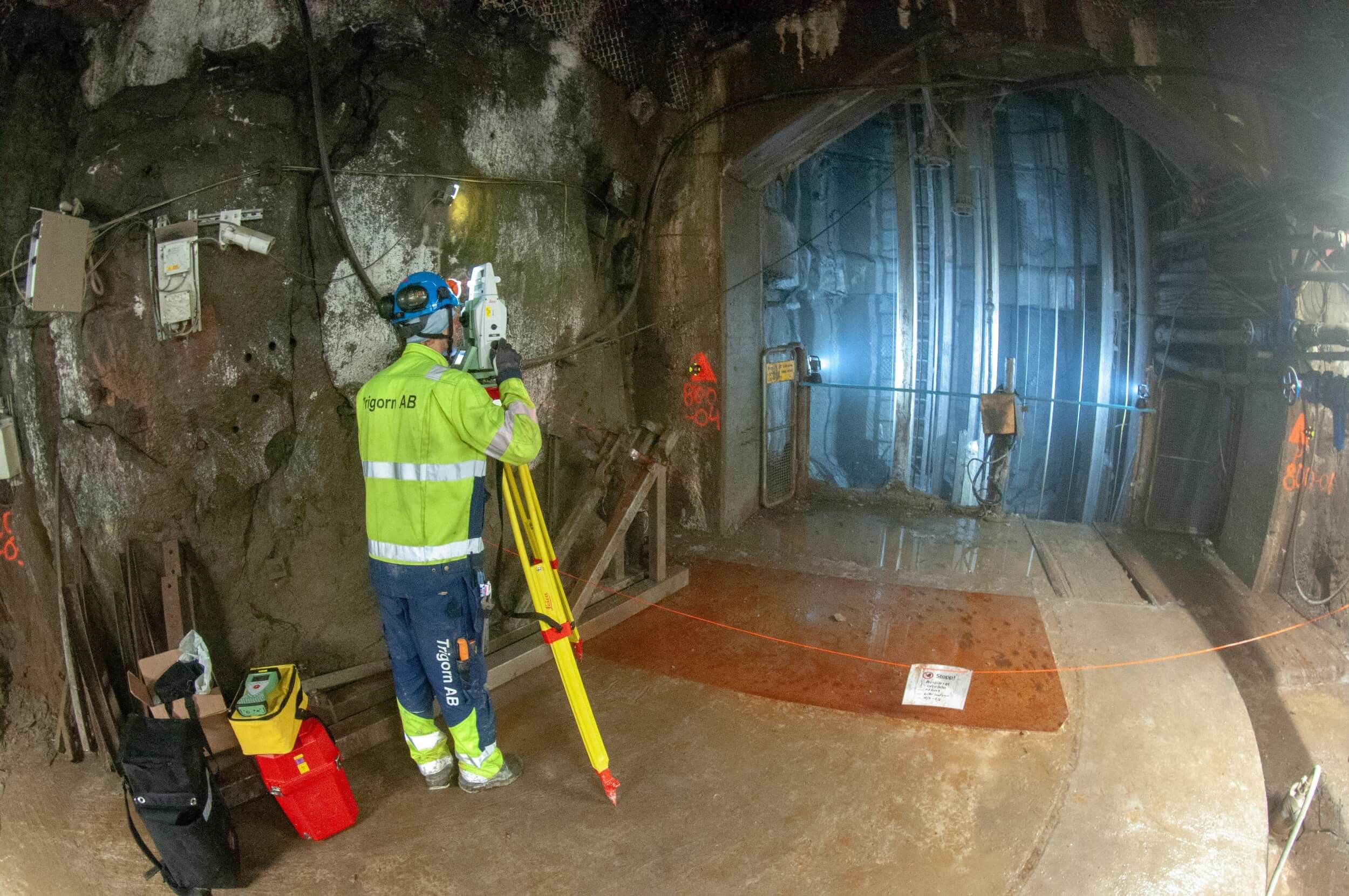
filter_center_focus Measuring the geodetic control network, Boliden, 2017
clear
| Tunnel contour |
→ |
Based on project documentation, we produce digital contours, which serve further as a basis for the design of the drilling plan, i.e. accurate geometric definition of each individual borehole in the face. |
| Borehole layout |
→ |
Our specialists will help you with the design of the digital drilling plans to ensure the best layout of boreholes possible, as well as their geometric accuracy. |
| Analysis |
→ |
In conjunction with the construction documentation, we perform an analysis of the mass, and of the underbreak and overbreak areas. That may result in a recommendation for the optimization of the drilling plan and reduction of economic costs while keeping the requirements for the geometric parameters of the structure. |
Realization
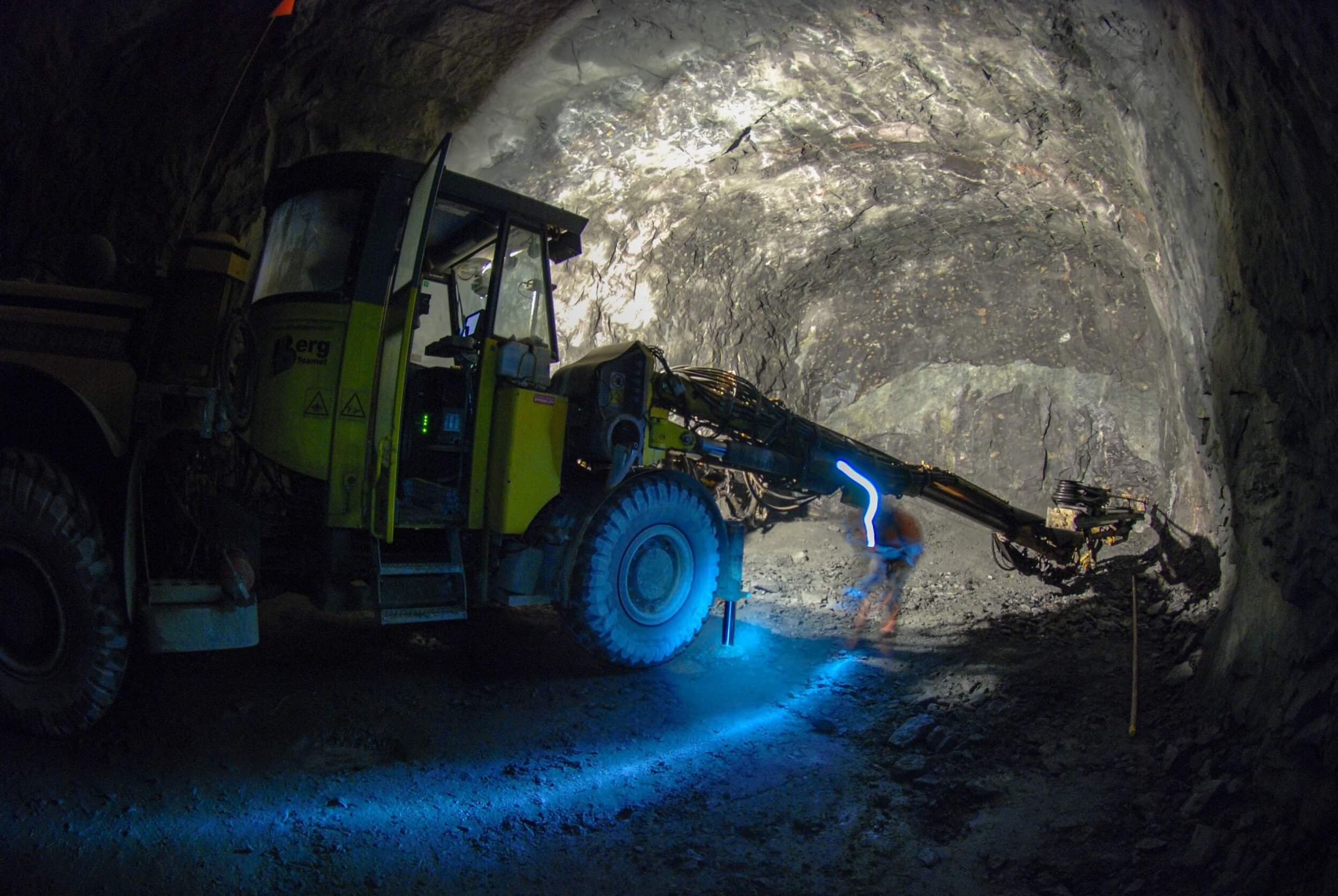
filter_center_focus Setting of the drilling rig, LKAB Malmberget, Sweden, 2018
clear
| Three-dimensional positioning |
→ |
We will arrange for you the setting out of the three-dimensional position of a mining structure and a structure carried out using mining techniques. |
| Detailed setting out |
→ |
We can provide setting out of structures within both surface and underground mines in all stages of the development of the mine. We also specialize in surveying structures carried out using mining techniques such as traffic tunnels, collectors, underground warehouses, and large-scale earthworks. |
| Excavation management |
→ |
We have extensive experience particularly with the drill/blast method. We provide direct setting out using a total station, data preparation for the semi-automatic navigation of drilling rigs or navigation using a fixed laser. We have broad experience with the Atlas Copco / Epirock systems. |
| Setting of the drilling rigs for technological and exploration boreholes |
→ |
We provide installation of machinery and navigation for drilling survey, technological and special production boreholes, including raiseboring. |
Realization
filter_center_focus Setting of the drilling rig, LKAB Malmberget, Sweden, 2018
clear
The survey part of the as-built documentation is an important part of the final handover of the structure. It often serves as the basis for further technical solutions during the operation, maintenance, planning, and assessment of security risks. We also provide this service of course, often in conjunction with setting out and creating a geodetic point field.
Realization
filter_center_focus Documentation for a shaft section, NCC, Sweden 2016
clear
We carry out monitoring of shifts and deformations by means of surveying methods within the campaigns of geotechnical monitoring. We have experience with long-term measurement in underground mines and tunnels, as well as on surface structures.
Realization
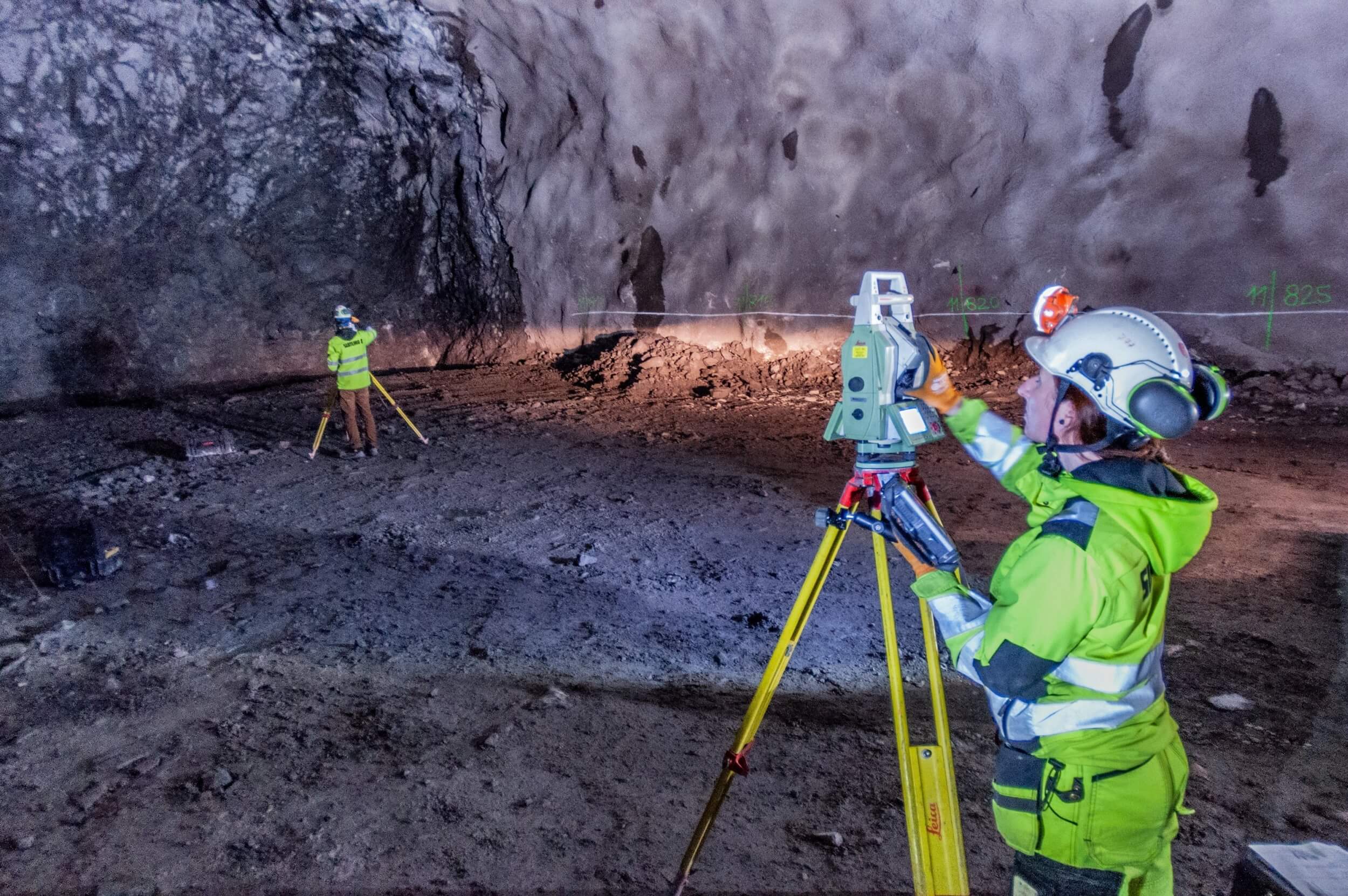
filter_center_focus Förbyfart tunnel bypass, Stockholm, Sweden, 2018
clear
Laser scanning of mine structures, both horizontal and vertical, is an important method of three-dimensional data collection providing a high degree of comprehensiveness and detail.
| 3D outputs |
→ |
We generate outputs, from black and white to colourful point clouds with high resolution to vector 3D models. |
| 2D outputs |
→ |
We generate straightforward 2D outputs such as sections and profiles enabling easier orientation in challenging projects. |
| Analysis |
→ |
We analyze data, and we carry out the calculations of mass and underbreak and overbreak areas for you; by comparing several phases of the measurement, we can we comprehensively analyze the deformations and shifts of structures. In tunnels and mines, we also do scanning with high density of points, or with HDR colour information, providing a valuable data file used for the purpose of a geotechnical analysis. |
Realization

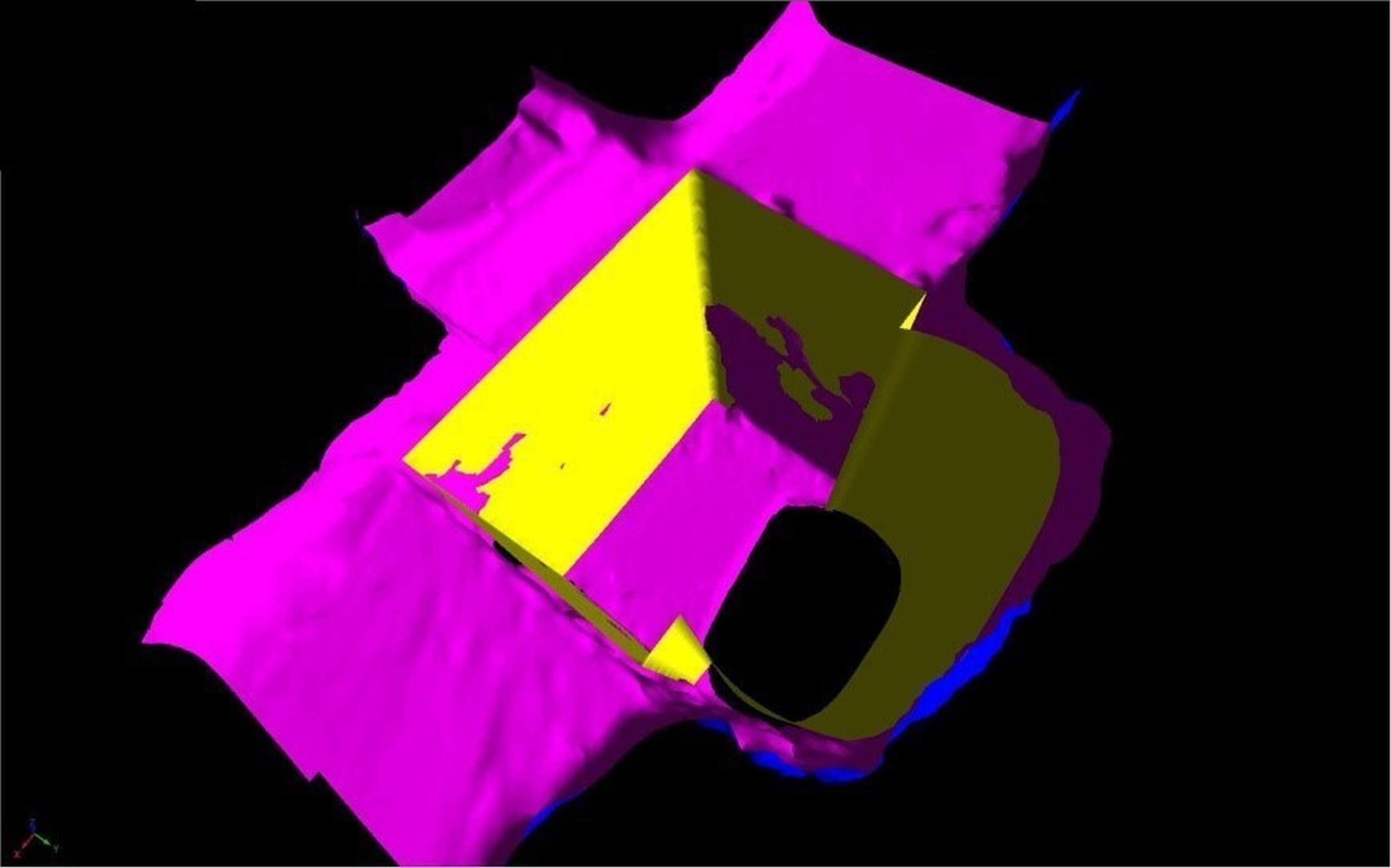
filter_center_focus Point cloud as an intermediate product of the documentation of the lining, Malmberget, Sweden, 2018
clear
Our specialists in mine surveying and engineering surveying in underground areas have extensive experience from projects of various size, duration and difficulty. We participate in the biggest projects in Europe, e.g. new mine level in the largest underground iron mine in the world in Kiruna, Sweden, or tunnel bypass in Stockholm. We provide services ranging from the creation of geodetical networks, through survey management of the excavation, as-built documentation, volume calculations and geotechnical monitoring, to setting-out and documentation of the technological equipment.
→
We work with certified and regularly calibrated Leica and Trimble equipment.
900m
We have experience with surveying shafts up to one kilometer deep.
40km
We left our professional footprint in fourty kilometers of tunnels.
